
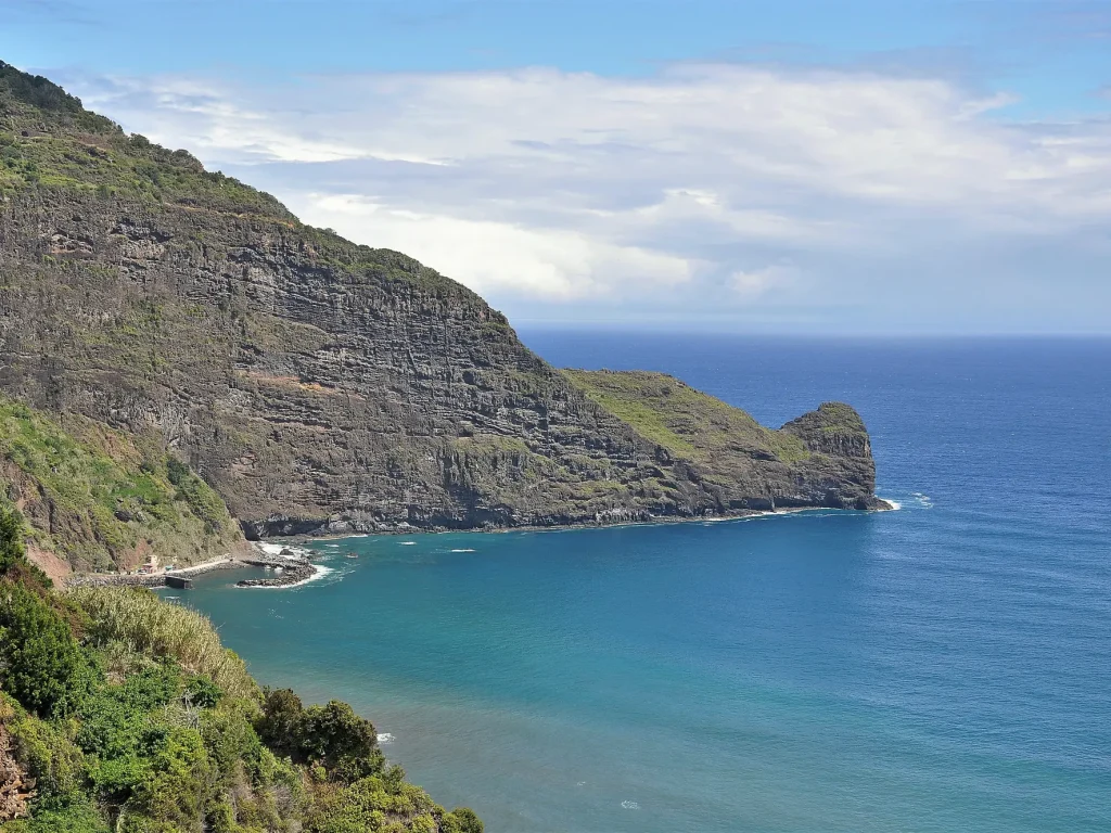
Ponta do Clérigo is a coastal viewpoint on Madeira’s north coast, in the parish of Faial, municipality of Santana, marking the eastern limit of the Rocha do Navio Nature Reserve, a marine reserve that runs west from here to Ponta de São Jorge. It has no official trail number, and hikers reach it via an unofficial route from the Levada do Cortado, with published hiker reports putting the round trip at roughly 6 to 6.8 km, steep and exposed in sections, over loose rock.
Unlike Madeira’s numbered PR trails, this one is not maintained or signed by the regional forestry institute (IFCN), which is worth knowing before you go: no official open/closed status is published for it, and no rescue infrastructure should be assumed.
The essentials
| Distance | 6 to 6.8 km round trip. Published hiker reports vary, and there is no official trail data |
| Elevation gain | 450 m to well over 700 m depending on the route taken. Hiker reports disagree sharply, so plan for the harder figure |
| Time | 2 to 5.5 hours for the full ridge, less for the levada-only variant. Budget half a day either way |
| Start | The Levada do Cortado trailhead, on the dirt road between Santana and Faial, near a short tunnel |
| Difficulty | Hard. Hiker reports consistently describe it as unsuitable for inexperienced hikers |
The figures above come from published hiker reports rather than an official source, and they don’t agree with each other, so treat them as estimates, not certainties, and plan for the harder end of each range.
The route
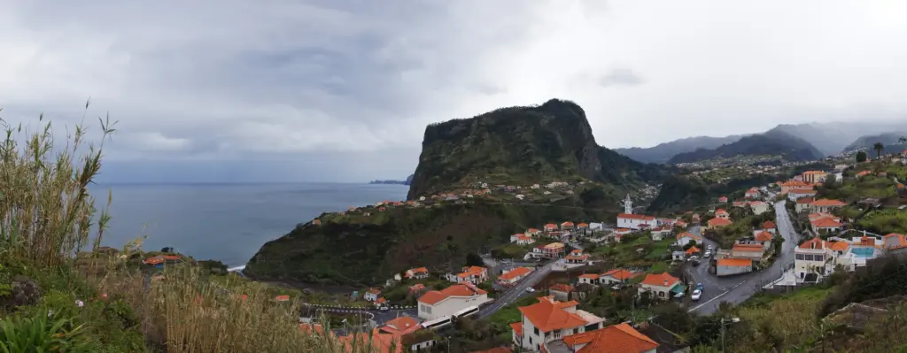
The walk begins at the Levada do Cortado tunnel above Santana. It follows the levada channel along the hillside, then continues along the path before reaching the road and heading out to the headland at Ponta do Clérigo.
The payoff is the ridge itself: a narrow spine of coastline with Penha d’Águia as the backdrop and views along the east coast. It is not a loop; you walk back out the way you came, and hikers report the climb back up as the hardest part of the day.
Getting to the trailhead
Drive to Santana, then follow the minor road toward Faial. The trailhead is on an unpaved section of that road, at a small levada tunnel rather than a car park. It is not the long road tunnel on the main Santana road. Parking is informal, roadside, and limited to a handful of cars. A car is effectively required to reach it.
Best time to go
The drier season, roughly May to September, and any settled-weather day give the best odds of a dry, low-wind walk. Start early morning for the best light on the ridge and to avoid the wind picking up later in the day. Avoid going soon after rain, when the path underfoot is at its most slippery, and check the IPMA forecast for Madeira’s north coast before you set out.
Safety
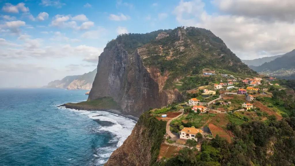
Because this is not an official PR trail, there is no IFCN closure notice to check before you go, which cuts both ways: nothing will tell you the path is unsafe today. Published hiker reports consistently flag the same hazards: exposed drop-offs on the final ridge, loose or unstable rock underfoot, and scrambling in at least one section. It is not recommended for anyone uncomfortable with heights; several reports describe a lower, less exposed variant for those who want the levada section without the ridge.
- Go with someone else. This is an unmarked, unofficial route with no signage or emergency infrastructure.
- Skip it in wet or high-wind weather. Loose rock and an exposed ridge are a bad combination in poor conditions.
- Turn back if the ridge feels beyond you. The levada section on its own is a worthwhile walk, and nobody is checking whether you reached the point.
What to bring
- Grippy hiking shoes. Boots or trail shoes with real tread, not trainers.
- 1.5 litres of water. There is nowhere to refill along the route.
- Sun protection. Hat and sunscreen for the exposed ridge sections.
- A windproof layer. The headland catches the wind even on calm days inland.
- A charged phone with an offline map. There is no signage on the unofficial sections.
Nearby experiences
If the appeal is the north-coast scenery rather than this specific route, our Full Day East Madeira Jeep Tour passes through the same Faial and Santana area by 4×4, no scrambling required.
For an easier, official alternative on foot, our guided levada walks in Madeira cover well-marked routes with a fraction of the exposure. And for another coastal walk on the island’s opposite tip, entirely different in character, see our PR8 Ponta de São Lourenço guide.
FAQ
No. Unlike Madeira’s numbered PR routes, it has no official trail number, is not maintained by the regional forestry institute, and has no published open/closed status. It is reached via the Levada do Cortado, an unofficial path above Santana, and no rescue infrastructure along it should be assumed.
There’s no official figure, and published hiker reports vary widely: round trips of 6 to 6.8 km, taking anywhere from about 2 to 5.5 hours depending on pace, fitness and exactly which route is walked. Budget the longer end of that range, especially if you’re stopping for photos along the ridge.
At the Levada do Cortado, on the unpaved road between Santana and Faial, marked by the small levada tunnel entrance rather than a signed car park. Parking is informal and roadside, limited to a handful of cars, and a vehicle is effectively required to reach the trailhead.
No. Published hiker reports consistently flag loose rock, scrambling and exposed drop-offs on the final ridge, and recommend against it for anyone uncomfortable with heights or without hiking experience. Several reports describe a lower, less exposed variant of the levada section for a gentler walk without the ridge.
No. It is an out-and-back walk: you follow the Levada do Cortado out to the headland and return the same way. Hikers report the climb back up as the hardest part, so keep energy and water in reserve for the return rather than spending everything on reaching the point.
Last checked 2 September 2026.


